Log in
All resources
Create a design
1,486 Free Images of Maps Of Africa
africa in the 1890s
maps from the earth and its inhabitants, vol. xii
maps from the earth and its inhabitants, vol. xiii
people of africa in the 1990s
maps from the earth and its inhabitants, vol. x
engraving on paper
koninklijke bibliotheek
1747 maps of africa
bibliothèque nationale de france
19th-century maps of africa
maps from the earth and its inhabitants, vol. xii
africa in the 1890s
maps from the earth and its inhabitants, vol. xiii
africa in the 1890s
maps from the earth and its inhabitants, vol. xiii
africa in the 1890s
maps from the earth and its inhabitants, vol. xiii
africa in the 1890s
19th-century maps of southern africa
1890s maps of africa
maps from the earth and its inhabitants, vol. xiii
africa in the 1890s
maps from the earth and its inhabitants, vol. xiii
africa in the 1890s
maps from the earth and its inhabitants, vol. xiii
africa in the 1890s
maps from the earth and its inhabitants, vol. xii
africa in the 1890s
maps from the earth and its inhabitants, vol. x
1890 maps of africa
maps by thomas kitchin
1780 maps of africa
maps by emanuel bowen
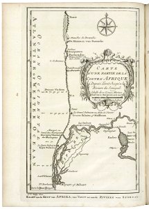
1747 maps of africa
17th-century maps of africa
maps from gallica
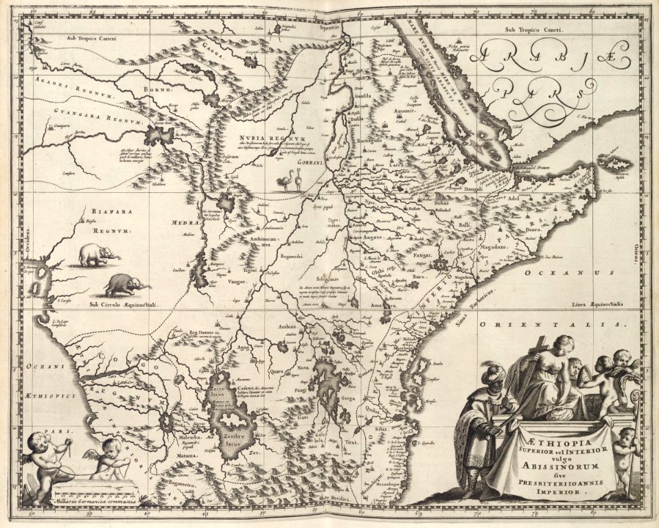
maps by willem and johannes blaeu
1630s maps of tunisia
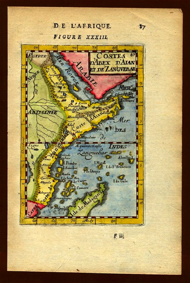
old maps of zanzibar
zanzibar in art
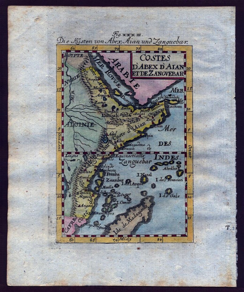
old maps of zanzibar
zanzibar in art
media contributed by university of illinois urbana-champaign university library
negroland
1890s maps of ethiopia
fra mauro map details
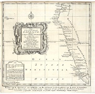
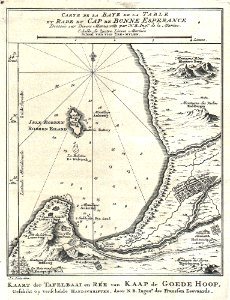
maps of the dutch east india company - south africa
old maps of the dutch east india company
eran laor cartographic collection
guillaume sanson
maps from the earth and its inhabitants, vol. xiii
africa in the 1890s
africa and its inhabitants, vol. ii
charles eugène perron
old maps of the dutch east india company - africa
1665
monsters on maps
ships on maps
monsters on maps
ships on maps
maps from the earth and its inhabitants, vol. xii
africa in the 1890s
maps from the earth and its inhabitants, vol. xii
africa in the 1890s
maps from the earth and its inhabitants, vol. xii
africa in the 1890s
maps from the earth and its inhabitants, vol. xiii
africa in the 1890s
africa and its inhabitants, vol. ii
charles eugène perron
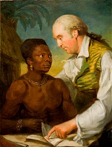
portrait paintings by carl fredric von breda
maps of africa in art
maps from the earth and its inhabitants, vol. xiii
africa in the 1890s
maps from the earth and its inhabitants, vol. xiii
africa in the 1890s
maps by jacques chiquet
1719 maps of africa
ismailïa. a narrative of the expedition to central africa for the suppression of the slave trade (1874)
1874 maps of africa
media contributed by university of illinois urbana-champaign university library
renaissance
bibliothèque nationale de france
1667 sanson map of africa
bibliothèque nationale de france
1667 sanson map of africa
maps by hendrik hondius the younger
maps from gallica
maps of the senegal river
1747 maps of africa
maps by willem and johannes blaeu
1648 maps of africa
maps from the earth and its inhabitants, vol. xi
africa in the 1890s
maps from the earth and its inhabitants, vol. xiii
people of africa
maps from the earth and its inhabitants, vol. xii
africa in the 1890s
maps from the earth and its inhabitants, vol. xiii
africa in the 1890s
maps from the earth and its inhabitants, vol. xiii
africa in the 1890s
africa in the 18th century
1794 maps of africa
eran laor cartographic collection
guillaume sanson
maps from the earth and its inhabitants, vol. xii
africa in the 1890s
maps from the earth and its inhabitants, vol. xii
africa in the 1890s
maps from the earth and its inhabitants, vol. xiii
africa in the 1890s
maps from the earth and its inhabitants, vol. xiii
africa in the 1890s
maps by emanuel bowen
1747 maps of africa
maps by willem and johannes blaeu
17th-century images of algiers
1771 maps of africa
maps by tomas lopez
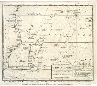
old maps of the dutch east india company - africa
maps of the dutch east india company - madagascar
maps by gerard de jode
1593 maps
maps from the earth and its inhabitants, vol. xii
maps of africa
maps from the earth and its inhabitants, vol. xii
africa in the 1890s
maps from the earth and its inhabitants, vol. xii
africa in the 1890s
maps of tunis and la goleta by braun & hogenberg
maps by willem and johannes blaeu
maps from the earth and its inhabitants, vol. xii
africa in the 1890s
the turkish empire in europe, asia and africa (1752)
1730s maps of the ottoman empire
maps from the earth and its inhabitants, vol. xi
africa in the 1890s
maps from the earth and its inhabitants, vol. xiii
africa in the 1890s
ptolemy's second projection
emery walker
old maps of the dutch east india company - africa
1668
maps of the dutch east india company - south africa
1668
maps of the west-indische compagnie
1668 maps of africa
eran laor cartographic collection
jacob van meurs
africa and its inhabitants, vol. ii
charles eugène perron
africa and its inhabitants, vol. ii
charles eugène perron
maps by willem and johannes blaeu
old maps of alexandria
maps of the west-indische compagnie
1668
maps from the earth and its inhabitants, vol. xiii
africa in the 1890s
jacques-nicolas bellin
1773 maps of africa
maps from the earth and its inhabitants, vol. xii
africa in the 1890s
maps from the earth and its inhabitants, vol. xii
africa in the 1890s
maps from the earth and its inhabitants, vol. xi
africa in the 1890s
maps from the earth and its inhabitants, vol. xi
africa in the 1890s
maps from the earth and its inhabitants, vol. xii
africa in the 1890s
maps from the earth and its inhabitants, vol. xii
maps of africa
maps from the earth and its inhabitants, vol. xii
africa in the 1890s
maps from the earth and its inhabitants, vol. xii
maps of africa
maps from the earth and its inhabitants, vol. xii
africa in the 1890s
maps from the earth and its inhabitants, vol. xii
maps of africa
maps from the earth and its inhabitants, vol. xii
maps of africa
maps from the earth and its inhabitants, vol. x
19th-century maps of africa
maps from the earth and its inhabitants, vol. x
19th-century maps of africa
maps from the earth and its inhabitants, vol. x
19th-century maps of africa
maps from the earth and its inhabitants, vol. x
19th-century maps of africa
maps from the earth and its inhabitants, vol. x
19th-century maps of africa
maps from the earth and its inhabitants, vol. x
19th-century maps of africa
maps by hendrik hondius the younger
1631 maps of africa
maps from the earth and its inhabitants, vol. xii
africa in the 1890s
1667 sanson map of africa
1667 maps of africa
maps from the earth and its inhabitants, vol. xii
africa in the 1890s
maps from the earth and its inhabitants, vol. xii
africa in the 1890s
maps from the earth and its inhabitants, vol. xiii
africa in the 1890s
maps from the earth and its inhabitants, vol. xiii
africa in the 1890s
201 - 300 of 1,486
Next page
/ 15